Backpack Operations
Learn to Grow Farm Digital Twin
general surface with URL-first state, server-shaped reads, and mobile-first operator flows.
Public access
Locations map
Click existing pins to inspect locations, or choose a location and use Add pin or Move pin for one-click map placement with normalized coordinates.
Locations
92
Mapped
7
Need pins
85
Invalid coords
0
Project map
Needs pin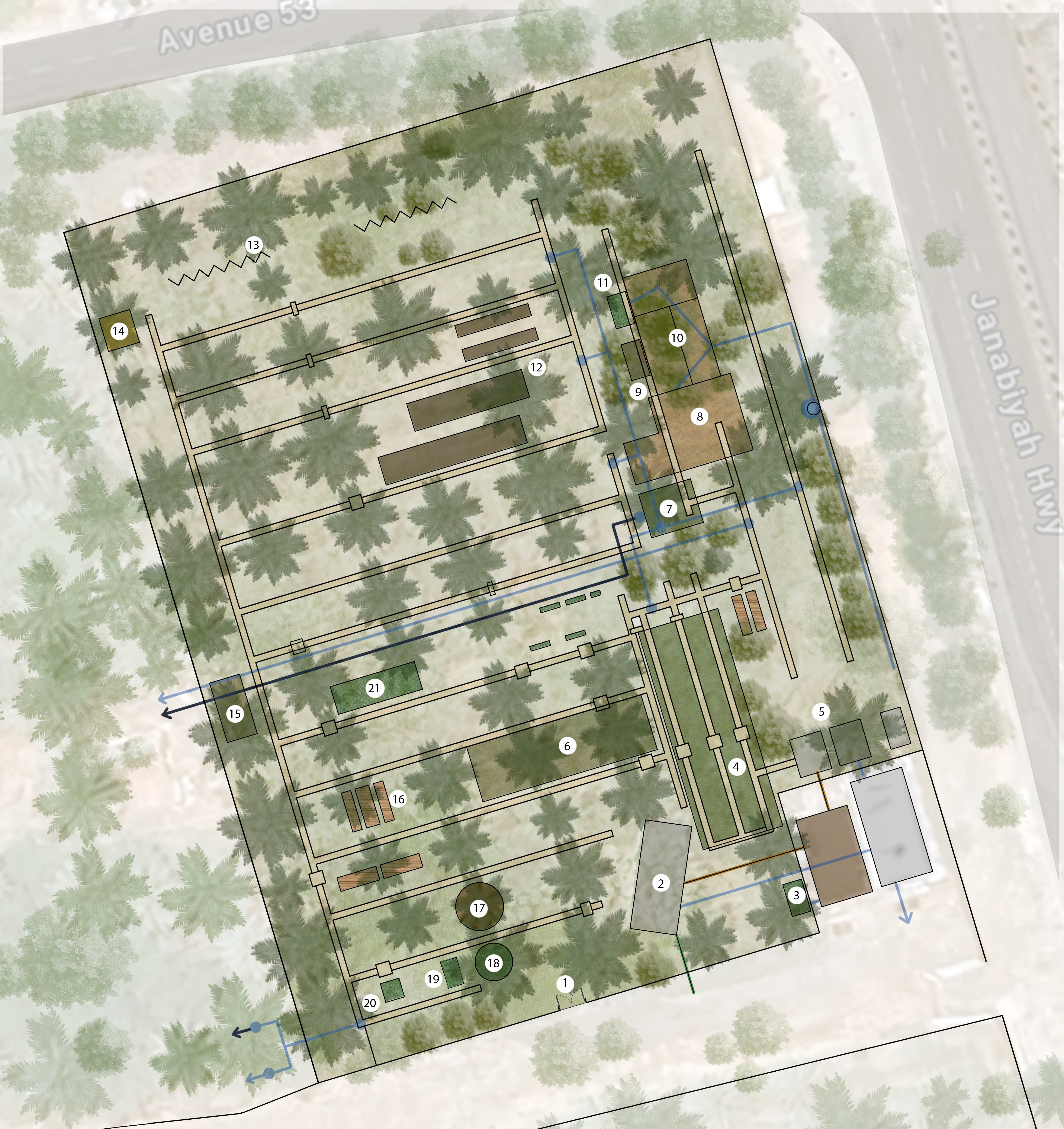
Patch
Saved: Unset
Click any pin to inspect it. Use Add pin or Move pin to change the selected location.
Patch
Current State: Current State: A ground-level patch area with sandy soil covered by mulch-like dry brown grass/straw material. Mulch layer observed in place, likely serving moisture retention or weed suppression function. Key Dates: None specified. Open Risks/Next Work: None active. Key Dates: None specified. Open Risks/Next Work: Open Risks/Next Work: None active.
Map status
Needs pin
Type
place
Last touch
2026-03-30T15:08:10.604663+00:00
Inventory links
1
Action links
0
Child locations
0
Parent locations
0
Updated at
Mar 30, 2026 3:08 PM
Description
Details
Map coordinates
Not set
Parent locations
- No parent locations
Child locations
- No child locations
Linked inventory
Linked actions
- No linked actions
Metadata
Created at
Mar 24, 2026 8:37 AM
Updated at
Mar 30, 2026 3:08 PM
Created by
fedbdd89-32fb-4cfb-ab29-478c889dfac3
Version
2
Location ID
d1810421-efed-4a10-ad16-952466b7d5d8
Needs pins
Select a location from this list, click the map, then save normalized coordinates.
Mapped locations
Already pinned on the project image. Select one to inspect or reposition it.